Available Translations:
GMEP results at a glance
Glastir impacts
The Glastir Monitoring and Evaluation Programme (GMEP) provides a robust, comprehensive programme to establish a baseline against which future assessments of Glastir can be made. GMEP has used methods from past surveys so results can be evaluated within a longer term perspective and national trends also reported. The use of models and farmer surveys provides early indicators of the likely direction, magnitude and timing of future outcomes and are presented here. The results indicate variable changes in farmer behaviour and modest benefits to those natural resources for which models are available. Opportunities to improve these outcomes include simplification of the woodland scheme, better targeting of other scheme offerings, and consistent support through time across all schemes to allow for lags in ecological responses.
Glastir impacts modelled for national outcomes:

Glastir impacts by farmers taking action for:

Figure Explanation: Early indications of Glastir impacts were captured by a mix of the GMEP Farmer Practice Survey to assess self-reported changes in farmer behaviour, and GMEP modelling of four Glastir outcomes at the national scale. (Note: Only three outcomes are shown because modelling to assess benefits for biodiversity cannot be scaled to national impact, although results suggested that for 75% of the 26 species explored benefits to habitat suitability would be delivered).
Characteristics and resilience of land in the Glastir scheme
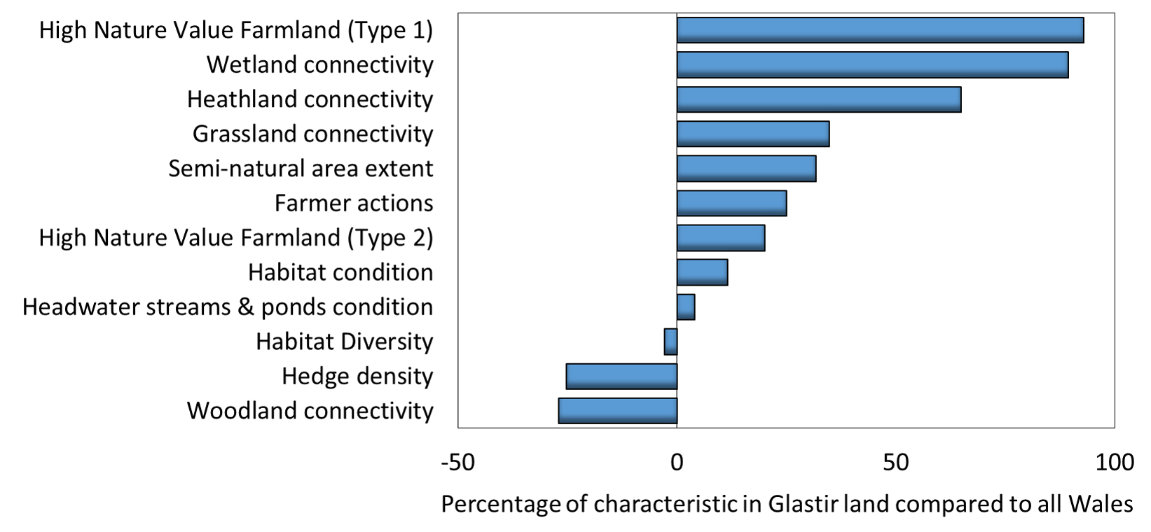
Documenting the differences in the type and condition of land in Glastir compared to all of Wales is essential for benchmarking future changes resulting from the scheme. Field survey and earth observation techniques have been used to capture these differences. The results show land in the scheme is more heavily dominated by semi-natural habitat than Wales as a whole, but there is little difference in overall condition and habitat diversity. Habitats in the scheme are generally better connected with the exception of woodlands. These landscape characteristics are thought to underpin ecosystem resilience and these results suggest land in the Glastir scheme may be more resilient to disturbance and stresses.
Characteristics of land relating to resilience:

Figure Explanation: Comparison of land in Glastir compared to land across all Wales for metrics related to resilience. Positive values indicate land in Glastir may be more resilient than land across all Wales. Negative values indicate land in scheme may be less resilient compared to all Wales. Future assessments will determine whether Glastir management further improves these landscape and farm system properties.
National trends
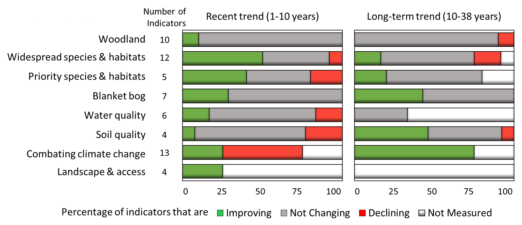
GMEP sampling strategy and methods have built on past surveys which allow long and short term trends to be assessed for a range of indicators for each Glastir Outcome. The indicators selected were considered the most relevant and appropriate for Glastir reporting by the GMEP Steering Group. The overall picture is one of stability and some improvement, although some areas for concern remain. The report found there are two to three times more indicators improving (26-30%) than declining (8-14%) in the short and long term, with the remaining 60% showing no change.
Glastir Outcome

Figure Explanation: Comparison of recent and long-term trends for Glastir outcomes using agreed high level GMEP indicators. Results are shown as the percent of indicators for each outcome that show statistically significant improvement, decline or no change. For some trends, not all indicators have been measured in the past, but GMEP has now provided a baseline to enable future reporting. Priority species and habitats and blanket bog are reported separately due to interest surrounding these results, particularly the impact of blanket bog restoration projects.
